|
Sundarbans
Located at about 320km. West of
Dhaka. Here in the south, spread over an area of
about 6000 sq. km. of delta swamps along the coastal belt of Khulna is the
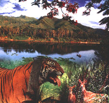
biggest mangrove forest, Sundarbans (beautiful forest) - the home of the Royal
Bengal Tiger. These dense mangrove forests are criss-crossed by a network of
rivers and creeks. One find here tides flowing in two directions in the same
creek and often tigers swimming across a river or huge crocodiles basking in the
sun. Other wildlife in this region is cheetahs, spotted deer, monkeys, pythons,
wild bears and hyenas.
The forest is
accessible by river from Khulna and Mongla. There are rest houses for the
visitors to stay and enjoy the unspoiled nature with all its charm and majesty.
Spending some times inside the forest can be a rare treat for the lovers of
nature. BPC offers package tours to Sundarbans.
Kaptai
Kaptai is an upazila under Rangamati
district. It is famous for hydro-electric project. A panoramic man-made lake
called Kaptai lake (680-sq. km.) in the midst of hills has added to its beauty. A pleasant and picturesque drive of 64 km.
from Chittagong brings you to huge expanse of emerald and blue water ringed with
tropical forest. Only 3 km. from Kaptai along Chittagong road, lies the ancient Chit Morong Buddhist
temple having beautiful Buddhist statues.
Kuakata
A rare scenic beauty spot on the southern
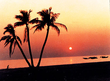
most tip of Bangladesh in the district of Patuakhali. It has a wide sandy beach
from where one can get the unique opportunity of seeing both the sunrise and
sunsetting. It is located at a distance of 70 km. from the district headquarters
of Patuakhali. Accessible by road, by air to Barisal and then by road, by river
vessel.
Kuakata, locally
known as Sagar Kannya (Daughter of the Sea) is a rare scenic beauty spot
on the southernmost tip of Bangladesh. Kuakata in Latachapli union under
Kalapara Police Station of Patuakhali district is about 30 km in length
and 6 km in breadth. It is 70 km from Patuakhali district headquarters and
320 km from Dhaka. At Kuakata excellent combination of the picturesque
natural beauty, sandy beach, blue sky, huge expanse of water of the Bay
and evergreen forest in really eye-catching.
Kuakata is one of the rarest places which has the
unique beauty of offering the full view of the rising and setting of
crimson sun in the water of the Bay of Bengal in a calm environment. That
perhaps makes kuakata one of the world's unique beaches. The long and wide
beach at Kuakata has a typical natural setting. This sandy beach has
gentle slopes into the Bay of Bengal and bathing there is as pleasant as
is walking or diving. Kuakata is truly a virgin beach-a sanctuary for
migratory winter birds, a series of coconut trees, sandy beach of blue
Bay, a feast for the eye. Forest, boats plying in the Bay of Bengal with
colourful sails, fishing, towering cliffs, surfing waves everything here
touches every visitor's heart. The unique customs and costumes of the 'Rakhyne' tribal families and Buddhist Temple of about hundred years old
indicate the ancient tradition and cultural heritage, which are objects of
great pleasure Kuakata is the place of pilgrimage of the Hindus and
Buddhist communities. Innumerable devotees arrive here at the festival of
'Rush Purnima' and 'Maghi Purnima'. On these two days they take holy bath
and traditional fairs are held here. All these additional offers to
panoramic beauty make the beach more attractive to the visitors. One
should visit Kuakata and discover the lovely grace of
Bangladesh.
Tamabil
& Jaflong
Situated amidst
splendid panorama, Tamabil is a border outpost on Sylhet-Shilong road, about 55
km. away from Sylhet town. Beside enchanting views of the area one can also have
a glimpse of the waterfall across the border from Tamabil. Jaflong is also a
scenic spot nearby amidst tea gardens and rare beauty of rolling stones from
hills.
Mainamati
An isolated low, dimpled range of
hills, dotted -with more than 50 ancient Buddhist settlements of the 8th to 12th
century A.D. known as Mainamati-Laimai range are extended through the centre of
the district of Comilla.
Salban Vihara, almost in the
middle of the Mainamati-Lalmai hill range consists of 115 cells, built around a
spacious courtyard with cruciform temple in the centre facing its only gateway
complex to the north resembling that of the Paharpur Monastery.
Kotila Mura situated on a
flaftened hillock, about 5 km north of Salban Vihara inside the Comilla
Cantonment are is picturesque Buddhist establishment. Here three stupas are
found side by side representing the Buddhist "Trinity" or three jewels i.e. the
Buddha, Dharma and Sangha.
Charpatra Mura is an isolated
small oblong shrinesituated about 2.5 krn. north-west of kotila Mura stupas. The
only approach to the shrine is from the East through agateway which leads to a
spacious hall.
The Mainamati site Museum
has a rich and varied collection of copper plates, gold and silver coins and 86
bronze objects. Over 150 bronze statues havo been recovered mostly from the
monastic cells, bronze stupas, stone sculptures and hundreds of terracotta
plaques each measuring on an average of 9" higli and 8" to 12" wide. Mairiamati is only 114 km. from Dhaka
City and is just a day's trip by road on way to
Chittagong.
Cox's Bazar
Located at a
distance of 152 km. to the south of Chittagong, Cox's Bazar is the
tourist capital of Bangladesh. Having the world's longest unbroken (120 km.)
beach sloping gently down to the blue waters of the Bay of Bengal against the
picturesque background of a chain of hill covered with deep green forests, Cox's
Bazar is one of the most attractive tourist spots in the world. Miles of golden
sands, towering cliffs surfing waves, rare conch shells, colorful pagodas,
Buddhist temples and tribes, delightful seafood - these are specialties of Cox's
Bazar.
The beach is
good for bathing, sunbathing and swimming. The breath-taking beauty of the
sun-setting behind the waves of the sea is captivating. Attractive local variety
of cigars and handloom products of the Rakhyne tribal families are good buys.
Their unique customs and costumes attract visitors.
Cox's Bazar is connected both by air
and road from Dhaka and Chittagong. Visits to the
fascinating picnic spot at Himchari, Teknaf,
Buddhist temple at Ramu and nearby island of Sonadia, St. Martin and Mohaskhali
are memorable experience of one's lifetime.
The Aggameda Khyang, Cox's Bazar : Equally elaborate in plan, elevation and decoration is
the Aggameda Khyang near the entrance to the Cox's Bazar town which
nestles at the foot of a hill under heavy cover of a stand of large trees.
The main sanctuary-cum-monastery is carried on a series of round timber
columns, which apart from accommodating the prayer chamber and an assembly
hall, also is the repository of a large of small bronze Buddha
images-mostly of Burmese origin-- and some old manuscripts. Beyond the
main khyang to the south there is an elevated wooden pavilion and a
smaller brick temple with a timber and corrugated metal root. Apart from
bearing an inscription in Burmese over its entrance the temple contains
some large stucco and bronze Buddha images.
Himchari : It is
about 32 km. South of Cox's Bazar along the beach, a nice place for picnic
and shooting. The famous "Broken Hills" and waterfalls here are rare
sights.
Inani : It is
about 32 km. South of Cox's Bazar and just on the beach, with the sea to
the west and a background of steep hills to the east. Inani casts a magic
spell on those who step into that dreamland. It is only half an hour's
drive from Cox's Bazar and an ideal place for Sea-bathing and
picnic.
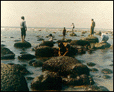
Maheskhali : An island off the coast of Cox's Bazar. It has an area
of 268 square kilometers. Through the centre of the island and along the
eastern coast line rises a range of low hills, 300 feet high; but the
coast to the west and north is a lowlying treat, fringed by mangrove
jungle. In the hills on the coast is built the shrine of Adinath,
dedicated to siva. By its side on the same hill is Buddhist
Pagoda.
Ramu :
This is a typical
Buddhist village, about 16 km. from Cox's Bazar, on the main road to
Chittagong. There are monasteries, khyangs and pagodas containing images
of Buddha in gold, bronze and other metals inilaid with precious
stones.
One of the most interesting of these temples is on the bank
of the Baghkhali river. It houses not only interesting relics and Burmes
handicrafts but also a large bronze statue of Buddha measuring thirteen
feet high and rests on a six feet high pedestal. The wood carving of this
khyang is very delicate and refined.
The village has a charm of its own. Weavers ply there trade
in open workshops and craftsmen make handmade cigars in their pagoda like
houses.
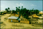
Sonadia Island :
It is about seven kilometer of Cox's Bazar
and about nine square kilometer in area. The western side of the island is
sandy and different kinds of shells are found on the beach. Off the
northern part of the island, there are beds of window pane oysters. During
winter, fisherman set up temporary camps on the island and dry their
catches of sea fish.
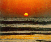
Teknaf :
Southernmost tip of Bangladesh, Teknaf situated on the Naaf river and just
at the end of the hilly regions of the district. Mayanmar is on the
opposite bank of Naaf river. Wild animals and birds are available but the
most interesting thing is a journey on the river. Wide sandy beach in the
backdrop of high hills with green forests is an enchanting scene never to
be forgotten.
Mahasthangarh
Located at a distance of 18 km. to the north of
Bogra town. Mahasthangarh is the oldest archaeological site of Bangladesh on the
western bank of river Karotoa. The spectacular site is an imposing landmark in
the area having a fortified long enclosure. Beyond the fortified area, other
ancient ruins fan out within a semi-circle of about 8-km. radius. Several
isolated mounds, the local names of which are Govinda Bhita Temple, Khodai
Pathar Mound, Mankalir Kunda, Parasuramer Bedi, Jiyat Kunda etc. surround the
fortified city.
This
3rd century BC archaeological site is still held to be of great sanctity by the
Hindus. Every year (mid-April) and once in every 12 years (December) thousands
of Hindu devotees join the bathing ceremony on the bank of river Karatoa. A
visit to the Mahasthangarh site museum will open up for one a wide variety of
antiquities, ranging from terracotta objects to gold ornaments and coins
recovered from the site.
Also
noteworthy are the shrine of Shah Sultan Bulki Mahisawary and Gokul Medh in the
neighborhood of Mahasthangarh.
Paharpur
In
Paharpur, a small village 5 km. west of Jamalganj railway station in the
greater Rajshahi district, the remains of the most important and the
largest known monastery south of the Himalayas has bee excavated. This 8th
century A.D. archaeological find covers approximately an area of 27 acres of
land. The entire establishment occupies a quadrangular court, measuring more
than 900 ft. and from 12fh to 15ft. in height with elaborate gateway complex
on the north. There are 45 cells on the north and 44 in each of other
three sides with a total number of 177 rooms. The architecture of the
pyramidal cruciform temple is profoundly influenced by those of South-East Asia,
especially Myanmar and Java. It had taken its name from a high mound, which
looked like pahar or hillock. A site museum built recently houses the
representative coactions of objects recovered from the area. The excavated
findings have also been preserved at the Veranda Research museum at
Rajshahi. The antiquities of the museum include terracotta plaques, images
of different gods and goddesses, potteries, coins, inscriptions, ornamental
bricks and other minor clay objects . It has been declared as a
World Heritage site by UNESCO.
|


